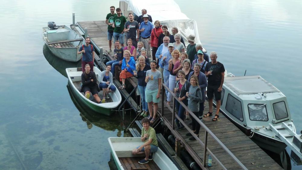
The entire CONNECT team at the start of the LakeLab experiment before the first sampling. | Photo: Martina Bauchrowitz/IGB
The CONNECT project revolves around lakes connected together along river systems. You intend to collect and analyse data that should make it easier in future to implement monitoring and protection measures for these lakes. Why focus on connected lakes?
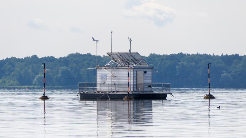
Stella Berger: The project involves us investigating a total of 19 lakes in Mecklenburg-West Pomerania and Brandenburg. These include the relatively strongly connected lakes along the Upper Havel, several lakes that form part of Feldberg Lake District that are not so strongly connected, and Lake Stechlin. Although the latter is only slightly connected to the surrounding lakes, the lake is home to the LakeLab, where we conduct experimental studies on the connectivity of lake systems. Lakes suffer disproportionately from anthropogenic pressures and the effects of climate change – for example, from extreme weather events such as heat waves, storms and warmer winters. In fact, most lakes along river systems are currently in a moderate to poor ecological state, and may not be able to meet the expectations of the European Water Framework Directive.
Which data is being collected and analysed?
Stella Berger:We collect multiple physical, chemical and biological data both above and below the water – from Secchi depth and optical calibration measurements to nutrients and organisms such as bacteria, phyto- and zooplankton, to exchange rates of greenhouse gases. Our measurements also include chlorophyll a and phycocyanin. These are pigments that indicate the occurrence of algae, of which cyanobacteria are a particularly important indicator for water quality. Measuring buoys that we installed in all 19 lakes provide us with continuous measurements. Our team additionally takes samples from the lakes at regular intervals, timed to coordinate with satellite overflights. The exciting thing is that we can match all the data we have collected on site with remote sensing data. This gives us a basis to improve bio-optical models to calculate chlorophyll concentrations from remote sensing data.
Sabine Wollrab: The remote sensing data originate from the optical earth observation satellites Sentinel 2A and 2B. Both satellites are equipped with multispectral cameras with a sufficiently high spatial resolution for medium-sized lakes. The satellites practically record the colour of the lake in specific spectral bands, the colour being dependent on factors such as water constituents and organisms. The state of freshwaters can then be assessed from these data. The Sentinels fly over our study area every two to three days. The problem is that there are often too many clouds in the sky, even when the weather is fine. Then the satellite images produced cannot be used. This is why taking our own ground-level spectral measurements is an important part of the project, because we then get data even when the sky is overcast.
How do you harness the data?
Sabine Wollrab: We want to determine chlorophyll concentrations from the optical measurements. To do this, the bio-optical models are being calibrated by comparing values with data collected on site. Once calibrated successfully, the remote sensing data can be used on a larger scale to support the monitoring and protection of freshwaters. You can see how representative a measuring point is for the whole lake, and can then, in principle, observe how a lake develops even between sampling dates. This is of interest for nature conservation authorities, for instance, which can then plan their measurement campaigns more accurately. After all, the remote sensing data can give an indication of when it makes sense to take on-site measurements.
Can you not do without them then?
Stella Berger: No, there is still a need to take on-site measurements of water constituents and to analyse the samples in the lab so as to obtain basic values for comparison with remote sensing data and ground-truthing. Satellite data enable us to optically record large areas, and therefore several freshwaters, simultaneously, but they are definitely not able to replace on-site measurements at present. Lake Stechlin, for example, has a low chlorophyll concentration, according to the satellite images, and is considered to be an oligotrophic lake. But this is only a reflection of the algae levels in the upper layers of water. In this lake, phytoplankton is hidden in the depths, which shows that the vertical distribution of algae – and of nutrients – is important to be able to assess water quality. In future, a combination of strategically positioned measuring buoys that also take vertical profiles and remote sensing could pave the way for targeted, optimally timed on-site sampling.
You started collecting data in May 2019. Do you have any preliminary results?
Stella Berger: Initial findings confirm our expectations that connectivity has an impact on lake systems. For instance, both remote sensing data and our own measurements show that the relatively strongly connected Havel lakes are similar and seasonally synchronised. We can infer this from the algae level, the composition of phytoplankton, and Secchi depth. The remote sensing data reveal a chlorophyll gradient along the flow direction of the Upper Havel, for example from the Zotzensee through the Labussee to the Ellbogensee. The type of lake – whether it is deep or shallow – also influences algae concentrations and composition. In contrast, less connected lakes tend at the same time to have a more individual character.
Sabine Wollrab: In the CONNECT project, we also analyse the exchange of greenhouse gases between water and the atmosphere. The aim is to determine whether there is a connection between algae blooms and the emission of climate-relevant gases such as methane and carbon dioxide. To do this, we use flux chambers to record the quantities of these gases released or absorbed by the lake. Initial results point to a high degree of seasonal variability, as well as showing major differences among lakes. We are currently looking into why that could be. Another important interim finding is that we managed to find out which of the various bio-optical models works best, and to calibrate it so as to provide excellent readings. It all worked out.
CONNECT brings together experts from all kinds of disciplines, ranging from chemistry and physics to ecology and earth sciences. What was it like collaborating on such a scale?
Stella Berger: A challenge, by all means; we first had to agree on a common language. However, we found collaboration to be enormously exciting and motivating from the very beginning. Since various disciplines are involved, we produce all kinds of ideas that bring added value to the project. It takes such a diverse team to conduct a study in which so many parameters can be recorded in parallel and linked to each other.
Sabine Wollrab: It is also fascinating, for example, to explore standing and running waters using a combined approach. They tend to be separate disciplines in freshwater ecology. You learn a great deal from each other when you plan and implement such a project together, because it enables you to combine a variety of approaches and broaden your perspective.